Sri Lanka vector maps
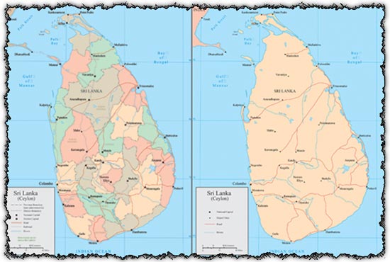
Description: Explore our collection of administrative maps depicting Sri Lanka, available in vector format for ease of use and customization. These maps provide detailed insight into the administrative divisions of Sri Lanka, perfect for various applications.
Features: Discover vector maps showcasing the administrative divisions of Sri Lanka, offering clarity and detail for comprehensive understanding. Vector format ensures scalability without loss of quality, allowing you to resize and customize the maps to suit your specific needs.
Usage: Ideal for researchers, educators, journalists, and businesses requiring accurate and up-to-date maps of Sri Lanka’s administrative regions. Use these maps for presentations, reports, educational materials, publications, and geographical analysis.
Graphics: Experience the convenience of vector maps, which can be easily edited to highlight specific regions, add annotations, or integrate into larger design projects. Enjoy the clarity and precision of each map, providing valuable geographic information at a glance.
Download Now: Download our Sri Lanka Vector Maps collection to access detailed administrative maps of Sri Lanka, designed to meet your mapping needs with accuracy and versatility.
HELLO, PLEASE TURN YOUR ADBLOCK OFF IN ORDER TO DOWNLOAD THE FILE!
It looks like you're using an ad blocker. That's okay—who doesn't? But without advertising income, we can't keep making this site awesome.


Cool, Thanks..
thanx lot….!!!!!
coool……………..