Bolivia vector maps
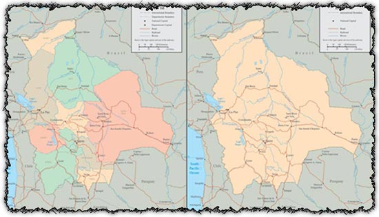
Description: This download includes two AI vector maps showcasing Bolivia’s administrative divisions. Each map is meticulously crafted to accurately represent the country’s geographical features and administrative boundaries. The accompanying JPG previews offer a glimpse of the detailed cartography and informative layout of the vector maps.
Usage: These Bolivia vector maps are invaluable resources for cartographers, educators, researchers, and anyone in need of accurate geographic representations of Bolivia. Use them in presentations, educational materials, research papers, or any project requiring geographical context or mapping of Bolivia’s regions.
Download: Access the AI vector files and JPG previews to explore the intricate details and comprehensive coverage of Bolivia’s administrative divisions. Customize the maps to suit your specific needs using vector editing software, and incorporate them seamlessly into your projects for enhanced visual communication and geographic representation.
HELLO, PLEASE TURN YOUR ADBLOCK OFF IN ORDER TO DOWNLOAD THE FILE!
It looks like you're using an ad blocker. That's okay—who doesn't? But without advertising income, we can't keep making this site awesome.



very good work
COOLL
Gracias me ayudaron en mi trabajo atte un desingnerr..